What are Drone Volume Measurement Software?
Drone volume measurement software is a specialized tool used in the field of aerial surveying and mapping. This software allows users to accurately measure the volume of objects or terrain features by analyzing data collected from drone flights. By utilizing advanced algorithms and processing techniques, drone volume measurement software can generate detailed 3D models and calculate precise volume measurements with high levels of accuracy. This technology is particularly useful in industries such as construction, mining, agriculture, and land management, where accurate volume calculations are essential for planning, monitoring, and decision-making purposes. In summary, drone volume measurement software is a powerful tool that leverages drone technology to streamline the process of volume measurement and analysis in various industries.
Why are Drone Volume Measurement Software Important?
Drone volume measurement software is important for a variety of reasons. Firstly, it allows for accurate and efficient measurements of large areas or volumes that would be difficult or time-consuming to measure manually. This can be particularly useful in industries such as construction, agriculture, and mining where precise measurements are crucial for planning and decision-making. Additionally, drone volume measurement software can help improve safety by reducing the need for workers to physically access hazardous or hard-to-reach areas for measurements. Overall, this technology streamlines processes, increases accuracy, and enhances productivity in various fields.
Technologies Used in Drone Volume Measurement Software
Drone volume measurement software utilizes a variety of technologies to accurately calculate the volume of objects or areas from aerial images captured by drones. These technologies include photogrammetry, which uses overlapping images to create 3D models of the target area; LiDAR (Light Detection and Ranging) sensors, which use laser pulses to measure distances and create detailed point clouds; GPS (Global Positioning System) for accurate geolocation data; and computer vision algorithms for image processing and analysis. By combining these technologies, drone volume measurement software can provide precise and efficient measurements for various applications such as construction, mining, agriculture, and environmental monitoring. Brief Answer: Drone volume measurement software employs technologies such as photogrammetry, LiDAR sensors, GPS, and computer vision algorithms to accurately calculate volumes from aerial images captured by drones.
Recent Advancements in Drone Volume Measurement Software
Recent advancements in drone volume measurement software have revolutionized the way industries such as construction, agriculture, and mining track and analyze volumetric data. These software solutions utilize advanced algorithms and machine learning techniques to accurately calculate the volume of objects or terrain captured by drones. By automating the process of volume measurement, these tools save time and resources for businesses while providing more precise and detailed insights. With the ability to generate 3D models and accurate measurements in a fraction of the time it would take using traditional methods, drone volume measurement software is becoming an essential tool for various industries looking to improve efficiency and decision-making processes. Brief Answer: Drone volume measurement software has seen significant advancements in recent years, utilizing advanced algorithms and machine learning to provide accurate and efficient volume calculations for industries like construction, agriculture, and mining.
Application Areas of Drone Volume Measurement Software
The application areas of Drone Volume Measurement Software are vast and diverse, making it a valuable tool in various industries. One key application is in construction, where the software can be used to accurately measure stockpile volumes, monitor progress on construction sites, and plan for material usage. In agriculture, drone volume measurement software can help farmers track crop yields, assess field health, and optimize irrigation practices. Additionally, the software is useful in mining operations for calculating stockpile volumes, monitoring site conditions, and ensuring compliance with regulations. Overall, the software's ability to provide precise and efficient volume measurements makes it an essential tool in industries that require accurate data for decision-making and planning purposes. Brief answer: The application areas of Drone Volume Measurement Software include construction, agriculture, and mining, where it is used for measuring stockpile volumes, monitoring progress, assessing crop yields, and optimizing operations.
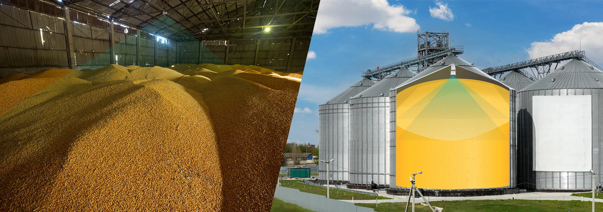
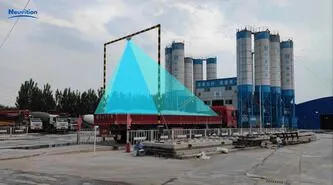
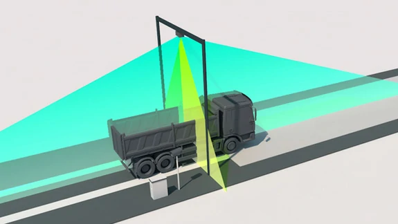
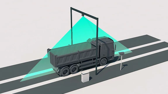
Neuvition Volume Measurement Solution
Neuvition offers a comprehensive volume measurement solution designed to meet the needs of various industries, including truck, warehouse, and outdoor pile measurement. Our solutions leverage advanced technologies to provide accurate, reliable, and cost-effective volume measurement data, enabling businesses to optimize their operations and make data-driven decisions.
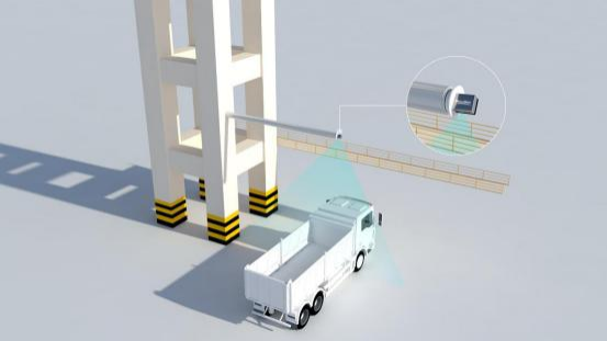
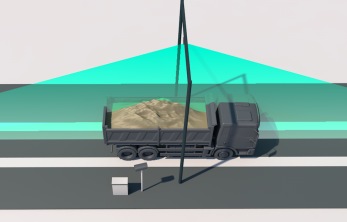
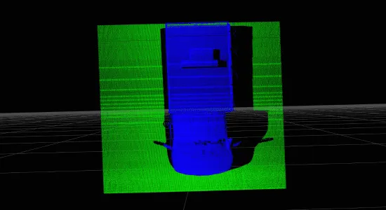
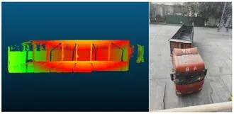
Neuvition Single Line LiDAR Solutions
Neuvition's Single Line LiDAR solutions, including the Titan M1 SL, Titan P1, and Titan W1 with PTZ, are designed to provide accurate and efficient volume measurement in various applications. These solutions combine high-resolution laser scanning with advanced software to deliver precise data and user-friendly interfaces, making volume measurement more accessible and effective than ever before.
FAQ


Contact Us
If you have any questions or suggestions, please leave a message, we will get in touch with you within 24 hours!